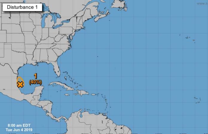
HARLINGEN — Hurricane season is here, but the Valley’s first brush with tropical weather will arrive without the drama.
A tropical disturbance slowly creeping up the coast of Mexico is going to bring potentially heavy rain to the Lower Rio Grande Valley today and Wednesday, breaking a dry cycle for some areas on the edge of drought.
Invest 91L is the focus of meteorologists and the National Hurricane Center as it becomes one of the first tropical systems in the hurricane season which began Saturday.
The tropical system has about a 60-percent chance for further development into a tropical depression or tropical storm and, if it does, it will be named Tropical Storm Barry. Due to the system’s proximity to the coast along the Bay of Campeche, experts give it virtually no chance of becoming a hurricane.
“Invest 91L, the tropical low, is expected to move toward the northwest over the next day or two along the northern Mexico coast to near the mouth of the Rio Grande,” Matthew Brady, a meteorologist with the National Weather Service in Brownsville, said yesterday. “It’s expected to stay rather disorganized but it could still become a tropical depression or a weak tropical storm.
“However, our main impact from this system will be the rainfall,” he added. “We’re expecting some beneficial rainfall to move into the region with about one to one-and-ahalf inches of rain possible, especially around the coast and into the Lower Valley.”
Drought-breaker?
As the rain hits the Valley today, Brady warned that embedded in the tropical moisture could be a few strong thunderstorms which could drop up to three inches of rain in localized areas. Some flooding in the usual spots could occur with this precipitation.
All of Cameron County and all but northwest Willacy County are listed as “abnormally dry,” which is the lowest rung on the drought ratings system issued by the U.S. Drought Monitor. The area is one of a handful of spots in Texas — or the country — registering any measurable drought as of last Wednesday.
“We are abnormally dry and with the recent stretch of hot and dry weather, those conditions are coming a little bit closer, even perhaps to minimal drought levels,” Brady said. “This may be very beneficial and right in time to help with that drought.”
Heat to follow After Invest 91L drags some tropical moisture into the region and departs, expect some tropical heat to follow in its wake. High temperatures on Friday and through the weekend will range from the mid-90s along the coast to 106 in the Upper Valley.
“That is because of that big upper-level pressure system over the desert southwest that will bemoving into North Texas,” Brady said. “This is going to drive the (tropical) system out of our way and to the gulf coast area to the north.
“It’s going to heat us back up for Friday and into the weekend,” he added. “We’re going to be quite hot and humid with heat indices returning in the 105 to 110 range, with some locations in the UpperValley eclipsing the 110-degree heat indices range.”


