
Sea surface temperatures well above average in the Atlantic Basin and the approaching return of La Nina are fueling early talk of a busy Atlantic hurricane season this year.
That doesn’t mean the Texas coast will see much if any tropical action, though as Barry Goldsmith, warning coordination meteorologist with the National Weather Service Brownsville-Rio Grande Valley station, likes to point out, it only takes one.
Meanwhile, the National Oceanic and Atmospheric Administration’s official hurricane season forecast won’t be here before late May (hurricane season is June 1-Nov. 30), though private and academic forecasters will start assembling their outlooks in March and, with growing frequency, into May, Goldsmith said.
Colorado State University, which over the years has earned a reputation as being among the most trusted non-NOAA hurricane-prediction entities out there, will reveal its first seasonal look on April 4 during a two-day National Tropical Weather Conference on South Padre Island, he said.
As for warnings of a wild hurricane season — AccuWeather is predicting a potential “blockbuster” — Goldsmith said it’s because waters of the Atlantic Basin are indeed very warm, plus there are indications that “upper oceanic heat content in the northwestern Caribbean may get an early jump later this spring.”
Also, the strong El Nino climate condition currently in place is expected to quickly flip to a weak to moderate La Nina in time for the peak of hurricane season, Sept. 10, he said. Even so, last year’s busy hurricane season happened despite a developing moderate to strong El Nino, with a warm Atlantic and frequent swirling atmospheric energy in the eastern and central Atlantic helping things along, Goldsmith said.
El Nino means warmer waters off the west coast of the Americas, usually producing warmer and drier than normal conditions in the northern United States and Canada, and wetter conditions along the Gulf Coast and Southeast. La Nina tends to produce the opposite, though El Nino is more common.
The 2023 season saw 20 cyclones, seven hurricanes and three major hurricanes, though for Texas coastal residents hurricane season essentially didn’t happen.
“While the Atlantic Basin may be quite active, that means nothing for our coastline,” Goldsmith said. “This is the same story every year.”
Thank “La Canicula,” the hottest, driest days of summer, which have been “an extended event” for most of the Valley’s warm seasons since 2011, and which tend to steer tropical weather away from deep South Texas, he said.
“A pronounced and prolonged La Canicula tends to shunt Caribbean/Leeward Island (tropical) events south of us, toward the Yucatan Peninsula and into areas from Tampico to Veracruz State,” he said.
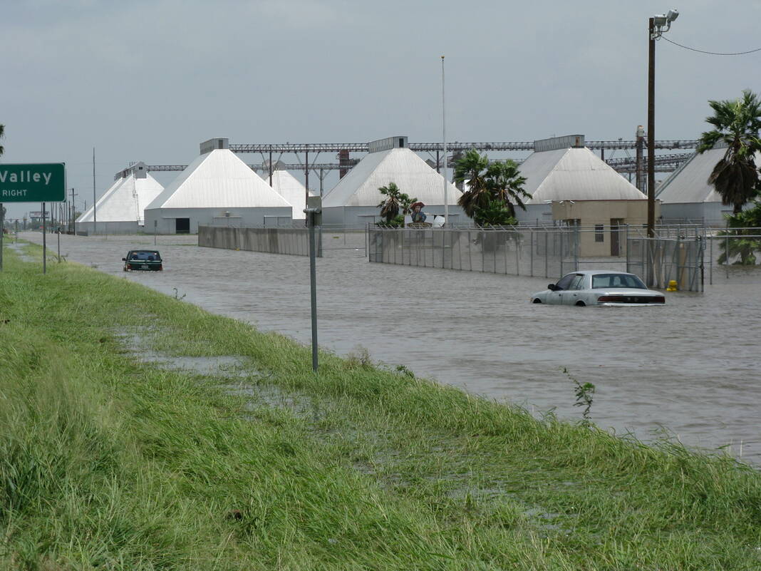
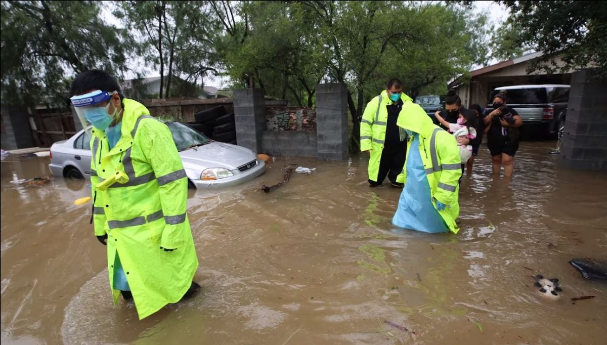
Still, one need look farther back than Hurricane Harvey in 2017 for proof that “it still only takes one,” Goldsmith said.
Harvey was the most recent case of a week-long break in the Canicula pattern that allowed an approaching cyclone to blossom into a monster storm thanks to all the puzzle pieces being in place — steering, low wind shear, very warm sea surface temperatures, and timing during the season, he said.
The result was $125 billion in damage, most of it in Texas, Goldsmith said.
“Remember, if Harvey had reformed just 160 miles to the west-southwest of where it ultimately did and held the same track, the direct strike would have been the lower Valley, with wind, flooding rain and surge impacts,” he said.


