|
Only have a minute? Listen instead
Getting your Trinity Audio player ready...
|
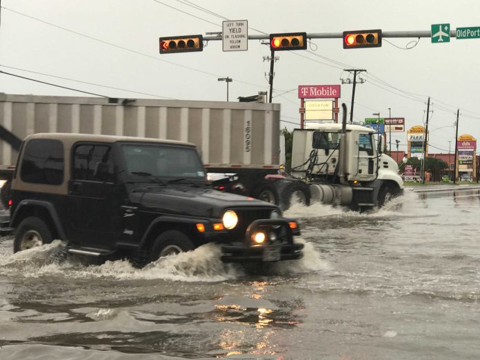
Many residents across the Rio Grande Valley on Tuesday woke up to flooded streets and power outages.
In Brownsville, not only were there flooded streets but resacas overflowing the banks. One such resaca is the one behind the Children’s Museum of Brownsville where the overflow ended up in the parking lot of the museum.
Heavy thunderstorms moved through the city early Tuesday morning dumping in some areas of Brownsville at least 6 inches of rain, if not more.
Brownsville Fire Chief Jarett Sheldon said the department responded to a couple of calls regarding sparking power lines. No water rescue calls came in, he said.
Sheldon said fire departments welcome the rain because Cameron County is currently under a burn ban because of the dry conditions.
The heavy rain and strong thunderstorms also surprised weather forecasters.
“We didn’t expect this much. We expected some pockets of heavy rain and it materialized and it did move directly over us. Some of the models yesterday (Monday) were decisive so it was to pass more to the north and for us to get some rain down here. We expected more of the heavier rain to occur out west like 2 to 3 inches but it came down a lot more than we anticipated,” said Geoff Bogorad, a meteorologist with the National Weather Service in Brownsville/Rio Grande Valley.
A strong upper-level disturbance passed through the Valley and it had plenty of moisture in it, well above normal moisture level in the atmosphere than the Valley usually has, Bogorad said.
And the rain is quite done yet, according to Bogorad, a cold front is expected to move through the Valley sometime Wednesday bringing more rain to it. “The support it has in pretty strong for May so the front should move through mid to late afternoon or if does slow down it may be Wednesday night…I can’t rule out another 2 to 3 inches in some locations which again will produce some localized street flooding in low lying areas.”
There’s a 50% chance of thunderstorms Wednesday night and a 20% chance of showers Thursday.
Because most of the Valley had not received a significant amount of rain in a while, the dry grounds immediately became saturated which caused flooding.
“When you get those rainfall rates of 2 to 3 inches an hour street flooding runoff is going to be rampant,” Bogorad said, but no widespread flooding into homes occurred.
According to the NWS, rainfall amounts from 7 a.m. Monday to 7 a.m. Tuesday were as follows: Brownsville, Harlingen and Los Fresnos received 3 to 3.99 inches of rain, while in the McAllen area there were between 6 to 7 inches of rain. Seven inches of rain was received at Falcon Dam.
The rain could help with the drought situation. According to the U.S. Drought Monitor Cameron County is abnormally dry and Hidalgo County is abnormally to moderately dry, Bogorad anticipates these ratings to change Thursday when a new drought monitor report is released.


