

If it seems wetter than normal for a Rio Grande Valley summer that’s because it is, with the latest round of relatively unseasonable moisture making an appearance this week.
The National Weather Service Brownsville/RGV station is warning of the potential for heavy rainfall and minor flooding in the Valley through July 10 due to a slow-moving upper level disturbance over South Texas. Northern ranch lands and western brush country into the Upper Valley were expected to receive the heaviest rainfall Tuesday into Wednesday, while isolated flash flooding is possible across the Valley, according to NWS.
The weather service predicted 4 to 8 inches of rainfall, mainly across the ranch lands and Upper Valley, with locally higher amounts through Saturday, and flash flooding and minor flooding especially in low-lying areas and areas with poor drainage. NWS also warned of the potential for “occasional to frequent cloud-to-ground lightning during thunderstorms.”
For Cameron County, Brownsville could be looking at 3 to 4 inches of additional rain through Friday and the Harlingen/Raymondville area an additional 4 to 6 inches, according to the forecast.
Rick Hallman, general forecaster with the Brownsville/RGV station, observed that early July in the Valley is normally “a little bit dry” in the absence of any tropical weather, but that rainfall for the region has been wetter than usual since around late May. The extra moisture associated with the current upper level disturbance started last week, he said. Substantial thunderstorms began swinging through Cameron County midday Tuesday.
In a typical summer, a subtropical ridge would have set up in northern Mexico by now, virtually guaranteeing dry weather for South Texas, Hallman said. This week’s wet spell, while it’s definitely sending the humidity into overdrive, does bring actual temperatures down to some degree, he noted. For example, Tuesday’s highs were in the upper 80s or lower 90s as opposed to the average of mid-90s in the Lower Valley and triple digits farther west, he said.
“That’s one benefit, kind of knocking down temperatures a bit,” Hallman said.
A rule of thumb of meteorology is that wet weather tends to produce more of the same, since there’s more moisture in the ground and the atmosphere to make rain, and dry weather likewise begets more dryness.
As Hallman puts it, “When it’s wet you kind of lean wet. When it’s dry you lean dry.”
How much of summer this type of wetter-than-normal scenario will persist is hard to tell because it can turn on a dime. The tropics are a wild card, meanwhile, with a more active than usual Atlantic hurricane season forecast for this year. At any rate, it’s safe to say that the coming weeks will be hot and miserable, even if slightly less hot and miserable than usual.
“Overall, it’s still summer in the Valley,” Hallman said.
All the same, more tropical weather nudges things toward wetter, and the Climate Prediction Center is forecasting that South Texas is “on the edge” of higher rainfall probability through September, he said.
“It’s looking that way and it looks like the trends will continue, but we’re real close to that edge,” Hallman said.
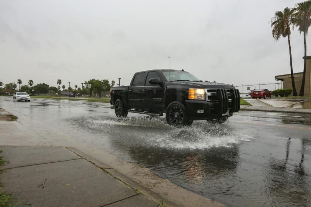
The flooding that inevitably results from episodes of heavy rainfall can be life threatening — a message NWS always tries to drive home during such times, he said
“We just always like to point out that most flood-related deaths happen in vehicles, so if you encounter flooded roads turn around. Don’t drown,” Hallman said.


