
|
Only have a minute? Listen instead
Getting your Trinity Audio player ready...
|
The National Hurricane Center on Monday afternoon issued a Tropical Storm Watch that is now in effect for Cameron, Willacy and Kenedy counties, as well as the for the entire Lower Texas Gulf waters.
The watch includes the cities of South Padre Island, Port Isabel, Laguna Vista, Laguna Heights and Port Mansfield, as well as the entire barrier island.
“The Tropical Storm Watch is for the potential for sustained winds of 39 mph with higher gusts, mainly from Tuesday night through Thursday morning in these areas,” a National Weather Service Brownsville-Rio Grande Valley Station notice states.
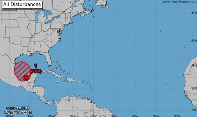
That notice states that the data are insufficient to classify the broad disturbance in the Bay of Campeche as a tropical cyclone, but the potential exists for a circulation with sufficient winds for the disturbance to be classified as such.
“Once winds reach 39 mph in any quadrant — assuming the circulation and environment meet the definition — the system would be named Alberto,” the notice stated.
Here’s the latest update:
RELATED READING:
Sweet relief: ‘Tropical entity’ to bring Valley much-needed rain
Cities, counties across RGV hand out sandbags ahead of heavy rains


