|
Only have a minute? Listen instead
Getting your Trinity Audio player ready...
|
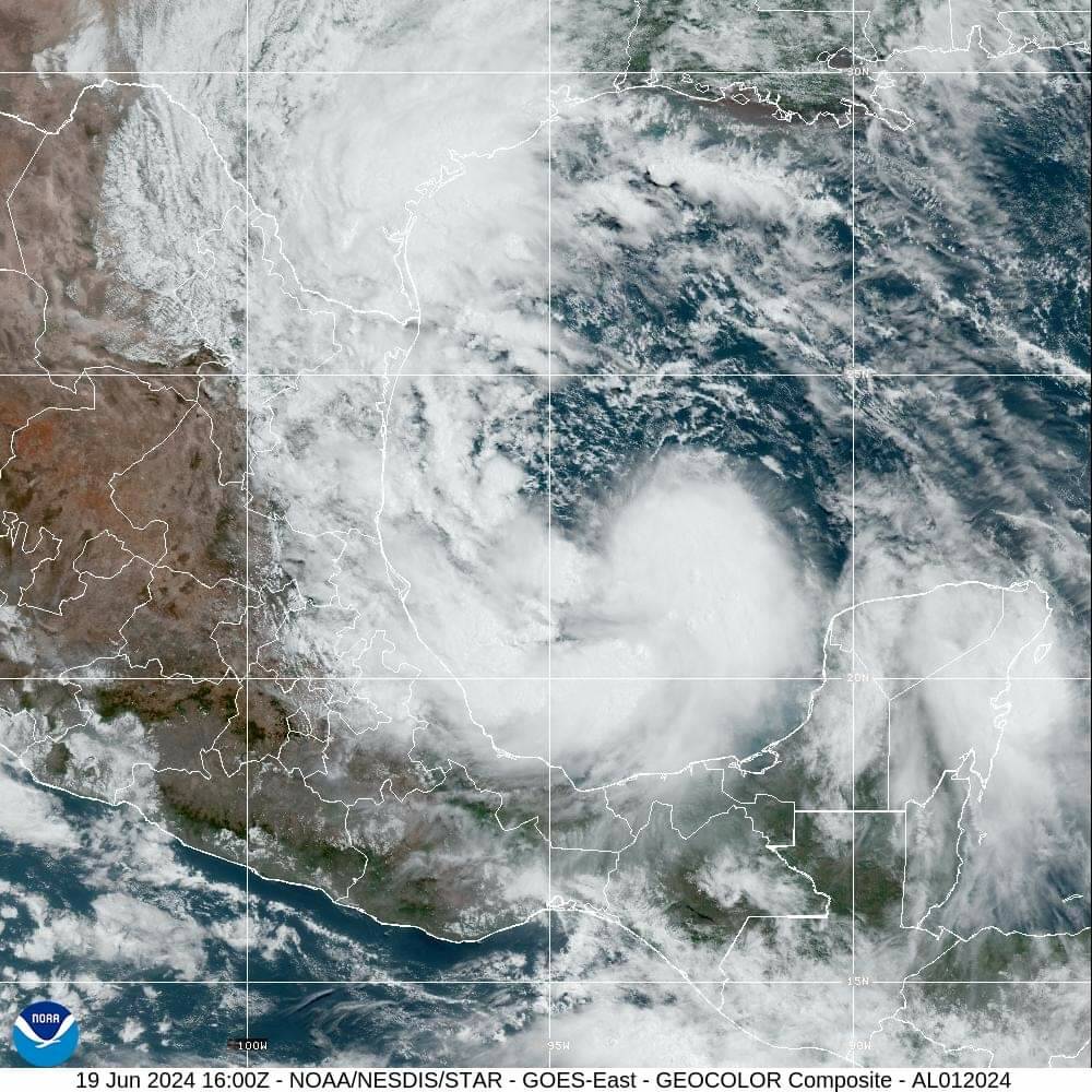
The tropical disturbance helping bring much-needed rain to the Rio Grande Valley officially became Tropical Storm Alberto Wednesday morning, according to the National Weather Service Brownsville-Rio Grande Valley station.
It’s the first tropical storm of the Atlantic hurricane season, which started June 1 and ends Nov. 30. The storm was located 185 miles east of Tampico, Mexico, beginning to gain steam as of Wednesday morning and expected to make landfall near Tampico before daybreak Thursday, the NWS said. The most significant rainfall for the Valley was expected Wednesday.
The weather service noted that more frequent rain bands associated with Alberto began Wednesday morning, though as of 11:30 a.m. no persistent swath of heavy rain (lasting 1-2 hours or longer) had developed, which made flooding less of a risk.
“If this continues, flood potential would be reduced as the quick-hitting showers, lasting 15 minutes or less, would tend to gradually soak in rather than run off quickly,” said NWS Warning Coordination Meteorologist Barry Goldsmith. “That said, a reasonable worst-case continues to suggest locations that could see 1-2 hours or persistent rains this afternoon and evening, now favoring locations from the mid/upper Valley to the Brush Country.”
He cited the chance of heavier rains forming in curved, east-to-west bands overnight into early Thursday near the coast, “as wind direction becomes more favorable.”
“This could create similar issues in all areas, beginning near the coast in the morning and spreading west across all areas in the afternoon,” Goldsmith said.
Total rainfall of 4-8 inches is expected, higher in some localized areas, though a lower expected rainfall total than predicted earlier this week, and the forecast could still change, he cautioned. Less total rainfall would mean fewer chances for flooding with very high water depth (3-4 feet) though with persistent rain bands the potential still existed for rapid-onset lesser flooding (2 feet deep) in places with poor drainage, the NWS said.
According to the latest forecast, tropical-storm-force gusts (39 mph or higher) were most likely in persistent or strong rain bands, or squalls. The highest wind speeds within those squalls later Wednesday into early Thursday could approach 50 mph, Goldsmith said, adding that wind-driven rain “could cause isolated to scattered, mainly neighborhood power outages, through Thursday.”

Outside of squalls, winds of 15-20 mph are more likely, with some gusts up to 30 mph. Stronger sustained winds of 20-30 mph, and gusts up to 40 mph outside of squalls, are likeliest along beaches and bays, the weather service said.
On Wednesday morning, water penetrating the dunes on South Padre Island caused calving, or erosion, in some places, mostly north of city limits, with peak tide levels 2-3 feet higher than predicted. Slightly higher levels were expected Thursday between 4-10 a.m. as “wave energy continues to pound the coast,” Goldsmith said, noting that high surf of 12 feet is likely through Thursday morning.
Unprotected shorelines could experience minor damage such as unmoored boats getting moved and damage to some docks, he said.