

Chilly winds and cold conditions will continue to pummel the Rio Grande Valley Saturday morning thanks to an arctic blast that brought frigid temperatures to the area.
And don’t be surprised if your outdoor water fountains will contain frozen water again.
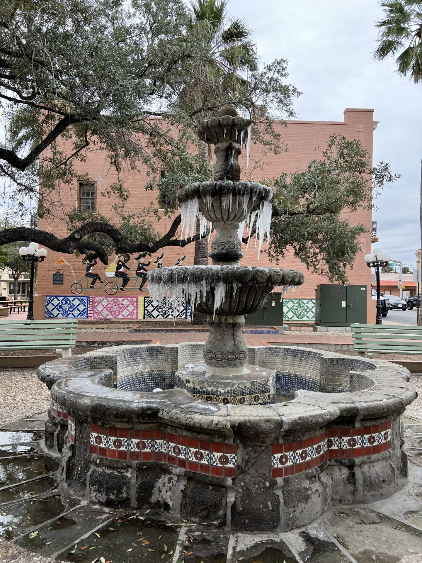
Water fountains in some parts of the Valley were frozen with icicles forming from the frozen water. At the National Weather Service in Brownsville/Rio Grande Valley an outside operation pan that was full of water on Thursday had iced up overnight.
“We have had a couple of people send pictures on one of our Facebook posts that we made…so people’s water fountains outside, bird baths and a few other things as well,” had frozen water in them, said David Reese, a meteorologist with the NWS. “That is going to happen when temperatures drop like that. Cold temperatures and really low dew points can really help things freeze a lot faster than usual.”
Reese said there’s a chance the same thing could happen Friday night into Saturday morning because of the similar weather conditions in the forecast.
A wind chill warning will remain in effect until noon Saturday, the NWS reports.
According to the NWS, the wind chills will be around 18 degrees in McAllen, 16 degrees in Port Isabel and 14 degrees in Harlingen and Brownsville.
A hard freeze warning will remain in effect through noon Saturday for Starr, Northern Hidalgo, and inland and coastal Willacy counties.
A freeze warning will be in effect also through noon Saturday for southern Hidalgo, Cameron counties and the Willacy and Cameron barrier islands.
If you are hoping for a cold Christmas, you will get one. The highs on Sunday, which is Christmas Day, will be in the mid to upper 40s. The temperatures on Christmas Eve will be in the low 30s.
This is 40 degrees cooler than it was on Christmas Day in 2021. The daytime temperature was 83 degrees with the overnight low around 69 degrees.
“Last Christmas was definitely on the toasty side,” he said.
Monday morning lows will once again take a big dip where temperatures are expected to be in the upper 20s to lower 30s for most of the Valley.
Monday’s highs will be in the upper 50s to lower 60s and Tuesday’s highs will be in the mid-60s to near 70 degrees.
There’s still a slight chance that icing or sleeting could happen in some parts of eastern Cameron and Willacy counties, closer to the coast, Reese said.
“You might hear a couple of pings of sleet, in other words those rain drops, that you’ll know it is sleet by the rain drops and they bounce and they don’t stick.”
There’s also a chance of freezing drizzle.
According to the NWS, additional isolated power outages could occur due to the cold temperatures, which was the case Thursday night into Friday, with outages reported in Hidalgo, Cameron, and Willacy counties.
The NWS reports the cold temperatures would likely affect the sea turtles once the coastal water temperatures drop to 50 to 55 degrees.
Officials said sea turtles can become “cold stunned” and float to the surface, unable to avoid watercraft, or wash up and become stranded along coastal shores.
The rescue of the turtles won’t likely begin until Christmas day when the winds and waves recede.


