
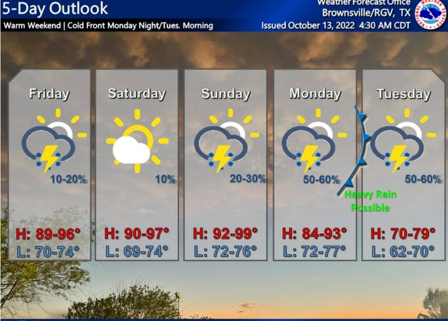
After weeks of waiting, the Rio Grande Valley will finally experience fall-like temperatures early next week as a cold front will make its way through the area late Monday night.
While it won’t be hot chocolate or caldo weather, the daytime temperatures next week will be in the upper 70s which is about a 12-15 degree drop from what the Valley is currently experiencing.
“Behind the cold front, much cooler temperatures are expected. Guidance has high temperatures in the 70s both on Tuesday and Wednesday and lows dipping into the upper 50s and lower 60s on Tuesday night,” the National Weather Service in Brownsville/Rio Grande Valley weather reports.
Tuesday’s highs will be near 78 while the overnight lows will be between 60 to 64 degrees.
The cold front will also bring rain with it and some of it could be heavy. There’s a 60% chance of rain on Monday, Monday night and into Tuesday. The rain chances drop down to 20% Wednesday.
According to the NWS, there is a “threat of isolated to scattered nuisance flooding and perhaps even pockets of flash flooding possible.”
“It’s a little early for precise forecast rainfall amounts, but early indications from model guidance show anywhere from 1 to 3 inches of widespread rainfall between Sunday and Tuesday, with higher amounts possible in heavier/training storms,” NWS added.
Valley residents will have to deal with warm temperatures before the arrival of the cold front. The high temperatures for Friday, Saturday, Sunday and Monday will be the lower 90s, while the overnight lows will be in the 70s.


