
A disturbance churning in the Gulf of Mexico has little chance of developing into a tropical storm, the National Weather Service in Brownsville/Rio Grande Valley reported Saturday morning.
The NWS reports northerly wind shear is pushing convection well away from the “center.” Hurricane Hunter Aircraft did not find a closed circulation but instead found a broader trough along the northeast Mexican coast early Saturday morning.
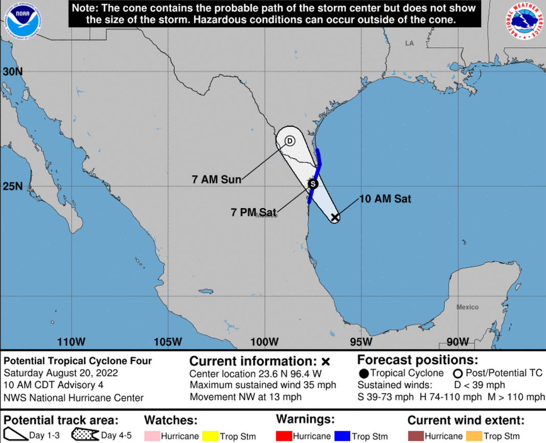
A tropical storm warning remains in effect for Cameron, Willacy and southern Hidalgo County due to anticipated tropical storm conditions. The NWS reported earlier this morning that there was a chance the warning could be canceled sometime Saturday afternoon.
According to the NWS, rainfall Saturday may be limited to the beaches and other near-coastal areas, with little more than a few ‘streamer’ showers moving from southeast to northwest inland between IH 69C (Hidalgo/Brooks) and the coast. Fair weather with light winds is expected most of the time tonight.
Stronger rain cells or “mini” bands could produce a quick 2 inches; if falling over poor drainage locations, this would produce brief minor flooding of up to 1 foot of water depth. Many areas may not see notable rain at all.
Wind gusts could still reach 35 to 40 mph, strongest in cells/bands near the coast or over the Gulf, in scattered showers/storms or mini bands. These gusts could blow lightweight unfastened objects around.
Waves at the beach will be choppy Saturday afternoon and Saturday evening, with a stiff south to north longshore current and some embedded rips.
Similar conditions are expected Sunday, with more afternoon sunshine than on Saturday. Swimmers should be aware of their entry point and maintain contact with the shoreline.


