HARLINGEN — The first major cold front of the year is headed toward the Rio Grande Valley and should arrive early Thursday morning and last until Friday afternoon.
The worst of the anticipated heavy rains and thunderstorms, some of which may be severe, will occur north of the area on Wednesday, however.
The front will bring cooler temps to the Valley, with highs Thursday and Friday in the mid-70s and lows in the mid-50s.
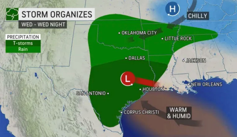
The cold front is expected to trigger localized flash flooding across the southern Plains on Wednesday, with the Texas cities of Dallas and San Antonio in line for significant downpours.
But the heaviest rain is forecast for Houston and Austin, AccuWeather forecasters say, as the cold front piles up against moisture and warm air rolling in from the Gulf of Mexico.
The jet stream will dip well to the south through the southern Plains during the event, according to AccuWeather Senior Meteorologist Matt Rinde.
“Low pressure will continue to move eastward into the Gulf Coast area on Thursday,” Rinde said.
“The Gulf of Mexico will still be a repository of abundant moisture for the region, and this system will allow for widespread rain and thunderstorms Wednesday into Thursday from west to east, especially along the Gulf Coast,” Rinde added.


