
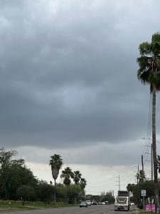
A strong line of thunderstorms will impact portions of Cameron and southeastern Willacy Counties through 4:45 p.m. today, according to the National Weather Service in Brownsville/Rio Grande Valley.
At 3: 5 2 p.m., Doppler radar was tracking a developing line of strong thunderstorms extending from 10 miles east of Port Mansfield to 6 miles southwest of San Pedro, the NWS reports. Movement was east-southeast or southeast at 20 mph.
Winds more than 40 mph are expected, with gusty winds that could knock down tree limbs.
Locations impacted include San Benito, Los Fresnos, Rancho Viejo, Rio Hondo, Arroyo City, Southmost, Olmito, Port of Brownsville, La Paloma and Cameron Park.
If outdoors, consider seeking shelter inside a building.
RELATED READING:
Cold front to bring cooler temperatures to the Rio Grande Valley


