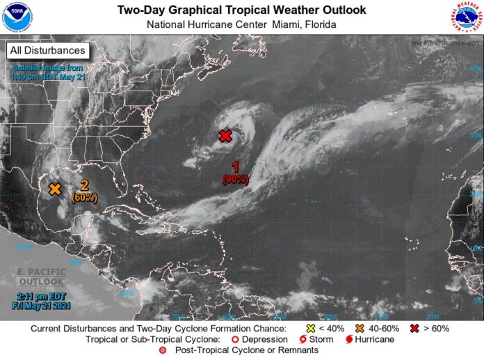
A disturbance in the Gulf of Mexico may develop into a tropical depression or tropical storm Friday.
The National Hurricane Center says satellite images suggests a low-level circulation is
forming over the western Gulf of Mexico off the Texas coast.
Satellite images show the storm is a well-defined low pressure system with winds of 30-35 mph. Rain and thunderstorms are expected to increase if a tropical depression or tropical storm forms before the system moves inland in southeast Texas and Louisiana.
The NHC center says regardless of development, the system could produce heavy rainfall over the next few days.
Out in the middle of the Atlantic, about 625 miles east-northeast of Bermuda, the first Atlantic disturbance of the year dropped from 90% to 80% on Thursday night.
If either system develops into a tropical storm it will be the first named storm of the year and receive the name Ana. The Atlantic hurricane season officially begins on June 1.
An average season consists of 14 named storms, according to the National Oceanic and Atmospheric Administration. Colorado State University estimates the 2021 season could have 17. AccuWeather also predicted a high estimate of 16-20 named storms. NOAA predicted 13 to 20 named storms including three to six major hurricanes.


