BY NORMAN ROZEFF
The floodway had been started in 1925. Levees were built one-quarter to one-half mile apart along what was termed a floodway.
This was through southern Hidalgo County to Mercedes thence in two directions — one extending north and east out across the southern tip of Willacy County to the Laguna Madre, the other emptying into the Arroyo Colorado and following that channel to the coast.
A smaller floodway was created out of the Rancho Viejo Resaca. Hidalgo county spent six million dollars in building its flood control system. Cameron County spent about one-third that amount. As noted previously after going six years without being challenged, the Rio Grande, in 1932, brought down large quantities of excess water. The big levees crumbled in some places and large amounts of cultivated land were flooded.
There was also a break in the north floodway levee that let water inundate much of Willacy County, doing extensive damage to farmlands in its southern part. Subsequently the mouth of the Arroyo Colorado was deepened along a nine mile stretch. $4.8 million was granted for Valley flood abatement, $1.6 which would be spent on emergency work.
The Arroyo Colorado was an ancient Rio Grande distributary that captured part of the Rio Grande flow when it flooded. In later years it also received excess agricultural irrigation flows and tile drainage outputs as well as treated municipal waste ones. Twenty-two miles of it are subject to tidal flows and make the Port of Harlingen accesible.
It is 89 miles long in its total. The first 29 miles of it with levees now extend from Anzalduas Diversion Dam on the Rio Grande near the city of Mission. This was accomplished in 1960.
Designed elevation differences prevent water from entering the North Floodway until the flow in the Arroyo exceeds 40 cubic feet (1.1 cu. M) per second. Designed flows are: Main Floodway = 105,000 cfs (2,970 cms); North Floodway = 84,000 cfs (2,380 cms); Arroyo Colorado east of Llano Grande Lake= 21,000 cfs (590 cms). The Arroyo Colorado watershed alone contains 130,300 acres or 203 square miles.
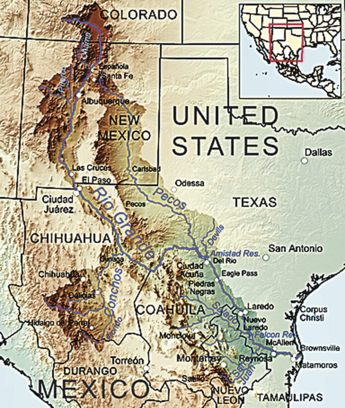
Importantly the United States and Mexico needed an agreement on the appropriation of waters in the lower Rio Grande. This was wrought in a mutually ratified treaty that stated that Texas would have all the rights from its own tributaries and that Mexico would assure 350,000 acre-feet annually to Texas from Mexican tributaries.
The treaties also anticipated the construction of two major reservoirs on the river.
These were to be Falcon Dam, completed in October 1953, and Amistad Dam, completed in 1969. Also established by the treaty was the International Boundary and Water Commission charged with coordinating the work between the two countries.
The ability of the flood control system to operate successfully was put to the test on September 20, 1967 and the days to follow as Category 3 Hurricane Beulah made landfall just north of the mouth of the river.
It was a slow moving system that dumped massive amounts of rain over the Valley and points west in the river’s watershed over a three day period. Heavy storms in August has previously saturated much of the LRGV.
At Rio Grande City the peak discharge occurred on September 22 at 210,00 cubic feet per second and 10 feet above flood stage. On the 25th, Mission experienced 206,000 and also 10 feet while on the 26th Hidalgo had 81,000 cfs and 6 feet. On the 29th San Benito registered 25,00 cfs and 6 feet above flood stage. The following day Brownsville registered 16,000 and 1 foot respectively.
The floodway was soon inundated with overflow waters from the rivers as well as runoff from the cities.
The airport of the City of McAllen was flooded on September 26 by waters from the Mission floodway that overpoured high ground about three miles west of the airport.
As floodway waters reached the division point near Progreso the majority of the flow diverted into the Arroyo Colorado.
This soon resulted in urban areas along the Arroyo in Harlingen being submerged by the flooded stream.
The crest was ten feet higher than that occurring in 1958 when in October-November spills at Falcon Dam and flood inflows from the San Juan River were the culprits.
An estimated 8,000 people, about 20 percent of the city’s population, required evacuation. It has been rumored over the years that Progreso area farmers might have somehow played a role in the failure of the control structure at the head of the Arroyo Colorado, but no facts have come forth to substantiate these suppositions. In addition, 20,000 agricultural acres outside of the river and interior floodways were inundated.
In September 1970, then in the U. S. House of Representatives, Kiki de la Garza introduced a large watershed plan for the LRGV that called for an investment of $84 million.
While it didn’t pass the House, it may have laid the groundwork for later appropriations, for in February 1971 Congress appropriated $29 million for the first phase of Valley flood control. In Beulah the U.S. took 70% of the excess water; now plans are for it to take 50%.


