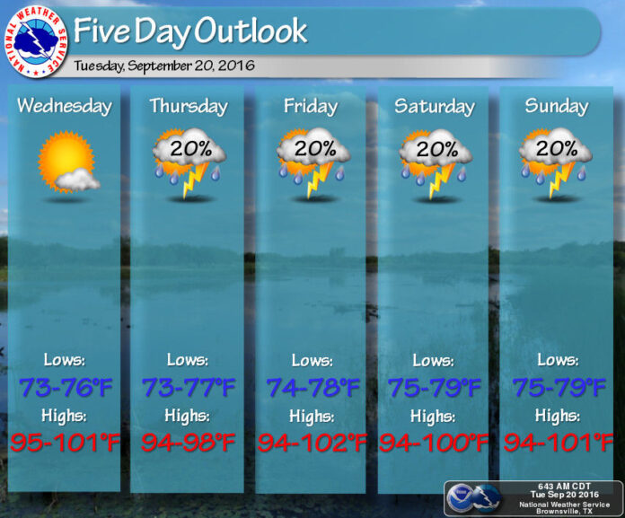
No, it’s not your imagination: It really has been an unusually hot late summer.
Thursday is officially the first day of fall, when the sun crosses the celestial equator from north to south, though that doesn’t mean much in the Rio Grande Valley, especially not this year.
The National Weather Service is forecasting a high of 96 degrees for Harlingen on Thursday.
Harlingen has tied its record highs of 98 and 99 degrees four days this month. Brownsville’s high of 98 on Monday tied the record for that date. McAllen broke its record with 104. Based on data since 1999, the average temperature for Sept. 19 is 90 for Brownsville and 92 degrees for McAllen.
“I can say pretty generally that this summer was in the top five hottest, maybe top three in some locations, and driest, too. That did not help things either — well, it helped it to be hotter,” said Jim Reynolds, meteorologist-in-charge for the NWS station in Brownsville.
With the ground dry, there’s no moisture to evaporate into the atmosphere to make rain, he said.
“It kind of feeds on itself,” Reynolds said. “Until you get a moist enough air mass to put some water on the ground, you can’t take water from the ground to build thunderstorms.”
The explanation for the higher-than-normal temperatures this summer is a persistent “super-duper strong, high-pressure” system over the southern part of the state, he said.
Don’t forget the heat index, which indicates how hot the air actually feels from your body’s perspective. Meteorologists calculate the heat index by combining temperature and dew point, or the temperature at which water vapor in the atmosphere turns to dew.
High humidity equals a high heat index, which is something very much worth paying attention to in the Valley for health reasons, Reynolds said.
“We have to add on the humidity component for us to really have a good idea what kind of stress it will be putting on our bodies if we spend a lot time outside,” he said.
Reynolds, who took charge of the Brownsville station just more than a year ago, said the tendency of the Valley’s weather to fall into a rut and stay there surprised him, and he expressed sympathy for the local TV weather anchors tasked with reporting it.
“It’s amazing here,” Reynolds said. “I didn’t expect it to be so persistent. You can expect it to be 96 every day from early to mid-June to late September to early October, with or without the chance of thunderstorms.”
Humidity is once again the culprit, he said.
“The moisture in the area really kind of keeps us locked into what we call the diurnal pattern: the daytime highs to the nighttime lows,” Reynolds said.
He agreed the Valley already has heat to spare and doesn’t need more, though that’s not the way things are moving, he said. It is getting hotter, said Reynolds, who doesn’t hesitate to point the finger at climate change, which he takes seriously.
It doesn’t mean every summer from now on will be hotter and drier than the previous one; some summers may be cooler and wetter than normal, he said.
“There will be fluctuations,” he said. “Unfortunately over time it will become hotter. That’s just the trend of things.”
Reversing that trend, if it happens, won’t occur in our lifetimes, Reynolds said. The good news, in the short term, is that relief in the form of cooler temperatures isn’t far off. South Texas should get its first real cold front around the third week of October or perhaps early November, Reynolds said.
“Personally speaking, this is my favorite time of year because the worst of the summer heat is behind us,” he said. “Even if it is still hot right now, it’s going to change soon.”


