

|
Only have a minute? Listen instead
Getting your Trinity Audio player ready...
|

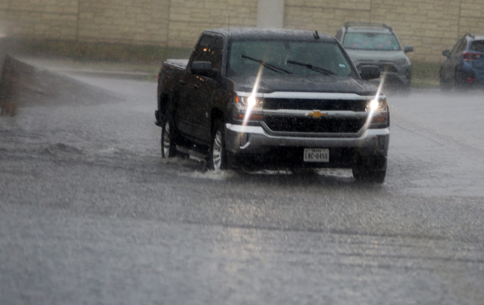
Right off the bat, September is living up to its reputation as the soggiest month of the year for the Rio Grande Valley, with thunderstorms cropping up around the region to dump their sometimes sizable loads.
The National Weather Service Brownsville-RGV station on Tuesday announced that, according to the Weather Prediction Center of the National Oceanic and Atmospheric Administration, deep South Texas and the Valley were at marginal to slight risk of excessive rainfall this week thanks to deep tropical moisture combined with daytime heating and low pressure, both at the surface and middle layers of the atmosphere.
Through sunrise Wednesday, meteorologists were predicting marginal risk for all communities in the Valley and deep South Texas, though only a slight risk for Sarita in Kenedy County. From sunrise Wednesday to sunrise Thursday, the outlook was for a marginal risk of excessive rainfall for all cities and towns in the region.
The NWS predicted 3-5 or more inches of rain in some areas from Labor Day through Saturday, while “isolated inflow regions to Falcon and Amistad (reservoirs) may see 10 inches of rainfall,” according to NWS Warning Coordination Meteorologist Barry Goldsmith.
The Valley’s communities depend on the reservoirs, as does agriculture, and water-usage restrictions are already in effect for municipalities across the region due to ongoing drought and historically low reservoir levels. Goldsmith said this week’s heavy precipitation will put a temporary end to the dry weather that was a main feature of August, along with many instances of excessive heat.
“The other temporary good news is some incremental rises in the reservoirs that supply water here,” he said. “Unfortunately, ‘incremental’ only raises levels from their record to near-record lows a little bit off that floor.”
Falcon, roughly 135 miles northwest of Brownsville as the crow flies, had fallen to near 10% of its total capacity as of Monday. Amistad, about 160 miles north of Laredo, ticked up from 19.3% to 19.6% in the recent days.
“(They are) still in record low territory,” Goldsmith said. “Enjoy the re-greening, but continue to conserve water as best as you can.”
The NWS on Aug. 30 said the National Hurricane Center was monitoring an area of disturbed weather over the northwestern Gulf, but gave it only a 20% chance of developing into tropical cyclone along the Texas coast over the following week. If it does develop, no direct impacts to deep South Texas or the Valley are expected, since it would mainly effect the upper Texas and Louisiana coast, according to the NWS.
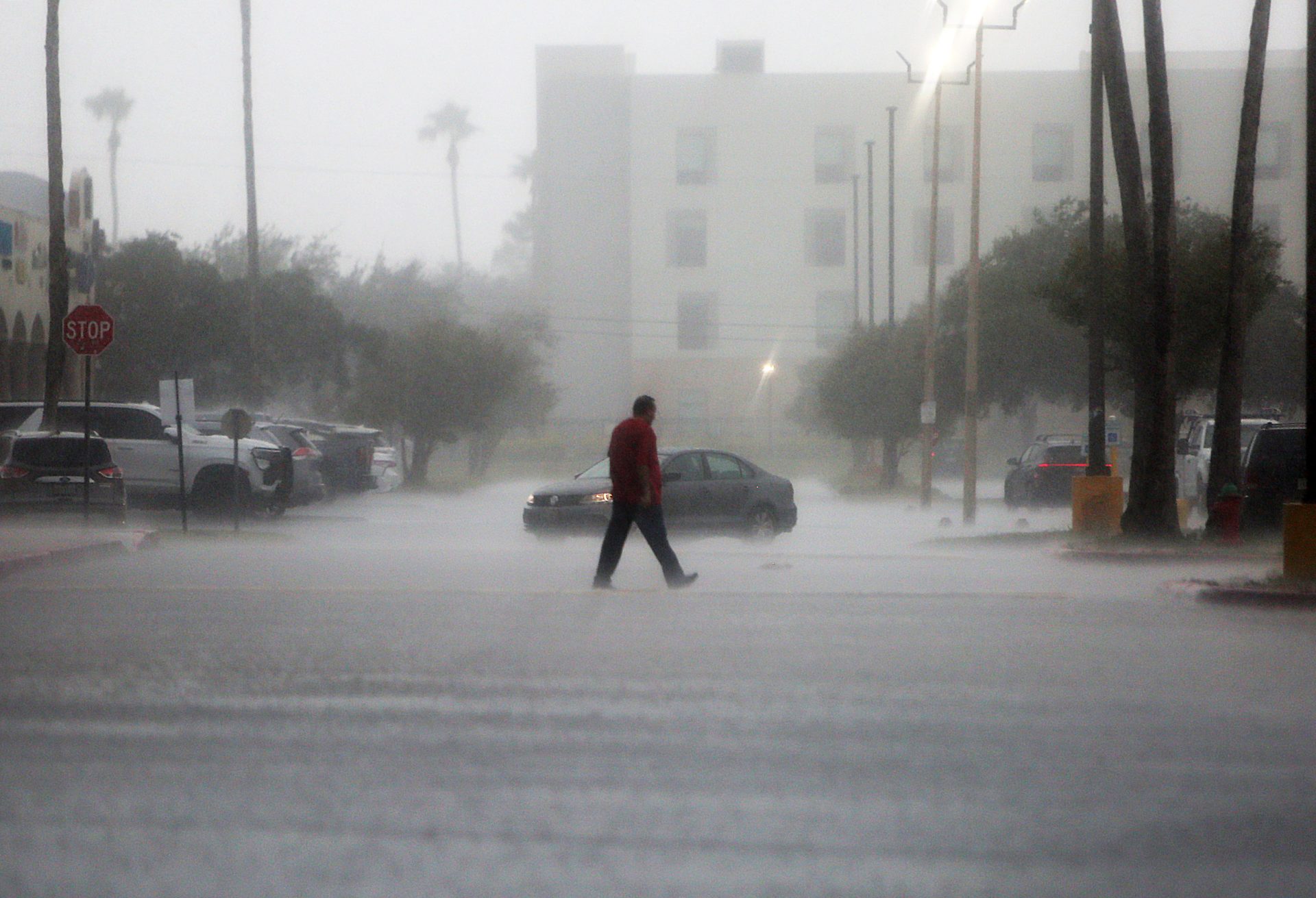
Still, torrential downpours — and lower temperatures — appear to be a given over the next several days, according to meteorologists, who are highly confident that this forecast is accurate.
Residents not ready for heavy rain should get ready for it, advised NWS Lead Meteorologist Joseph Tomaselli in a bulletin Tuesday. That means checking tire tread wear and pressure, and tire replacement if necessary; checking brake pads or shoes for wear and replace if needed; and check windshield wiper blades for dry rot. Rotted wiper blades should be replaced immediately for safety, he said.
To help prevent flooding, drainage ditches, clean-outs and canals should be cleared of debris. Where heavier bands of rain occur, “nuisance flooding” in areas with poor drainage is possible.
“Driving will be difficult in bands, with near zero visibility at times,” Tomaselli said. “Residents with NOAA weather radios or other apps in the affected should have them in “alert” (mode) in case flood warnings are issued.”


