
A cold front that will pass through the Rio Grande Valley Wednesday into Thursday could bring some strong thunderstorms and nuisance street flooding if the rain comes all at once, an NWS meteorologist reports.
The Valley could experience a similar weather pattern that occurred last week where several cities saw heavy rains and thunderstorms, said meteorologist David Reese, with the National Weather Service in Brownsville/Rio Grande Valley.
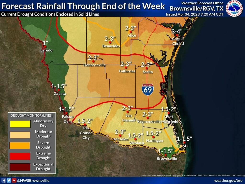
“Last week we saw some areas pick up 4 or almost 5 inches of rain and others didn’t see really a quarter to a half inch of rain, so there is that kind of range that we could see where that is that’s TBD (to be determined). And we won’t really know until we start to see some of the stuff form up,” Reese said.
As of Tuesday, the Valley is at a marginal risk of flooding, and the main concern is heavy rainfall that could produce amounts of up to 2 inches of rain.
“Thursday into Thursday night is looking like the wettest time period, and there’s a small chance that we could see some really localized flash flooding. But our biggest concern is street flooding at this time,” Reese said.
There’s a 30 to 40% chance of rain Wednesday afternoon, with the chances increasing to 45 to 70% Thursday afternoon and up to 80 to 90% Thursday night.
There’s a slight decrease Friday morning, with rain chances between 50 to 60%.
“Locally heavier amounts or higher amounts are possible as always within some of these showers or thunderstorms that we have here in Deep South Texas,” Reese said. “If we do see some of those heavier showers or maybe even thunderstorms develop, localized street flooding right now is the biggest concern.”
Thursday into Thursday night is looking like the wettest time period, and there’s a small chance that we could see some really localized flash flooding. But our biggest concern is street flooding at this time.
Although most of the Valley is categorized in severe drought conditions, Jim Hogg, Brooks and Kenedy counties could really use the rain because they are suffering from extreme drought conditions, Reese said.
During last week’s rain event, they only received about ¼ to ½ an inch of rain, he said.
The high temperatures on Thursday will be in the 70s, with overnight lows in the 60s.
The high temperatures on Friday will also be in the 70s.
The temperatures on Easter Sunday will be 78 to 82 degrees, with about a 25% chance of rain.


