
“Do not, do not, do not go out Monday morning,” warned National Weather Service forecasters in Brownsville after upcoming worst-case weather scenarios were confirmed Saturday afternoon.
Life threatening wind chill temperatures, hard and damaging freezes, and ice pellets and freezing rain are expected Monday in the Rio Grande Valley. People outdoors could face a critical danger for frostbite and death from 12 a.m. to noon on Monday and midnight to 9 a.m. on Tuesday.
NWS forecasters say the Arctic blast surges will be moving in between Sunday at 10 p.m. and Monday 4 a.m. They say rain will likely freeze as early as midnight to 3 a.m. on Monday for the Rio Grande Valley and starting earlier at 9 p.m. in north Zapata and north Kenedy.
Temperatures will dip significantly after sunset. They will range from 37 to 41°F around sunset and drop to 22 to 27°F between 6 to 9 a.m. Some ranchlands could register lows in the upper teens to lower 20s.
“Not just hanging near 32°F, we’re talking temperatures low to mid 20s in a lot of areas. We saw in Fort Worth, those were the temperatures that we saw an unfortunate circumstance where people were driving too fast on roads that had glazed ice like skating rinks,” Barry S. Goldsmith, National Weather Service Warning Coordination Meteorologist, said.
Wind chill, or the ‘feels like,’ could make the temperatures feel as low as 8 to 18°F, but it could even feel as cold as 5°F near the coast and across ranchlands.
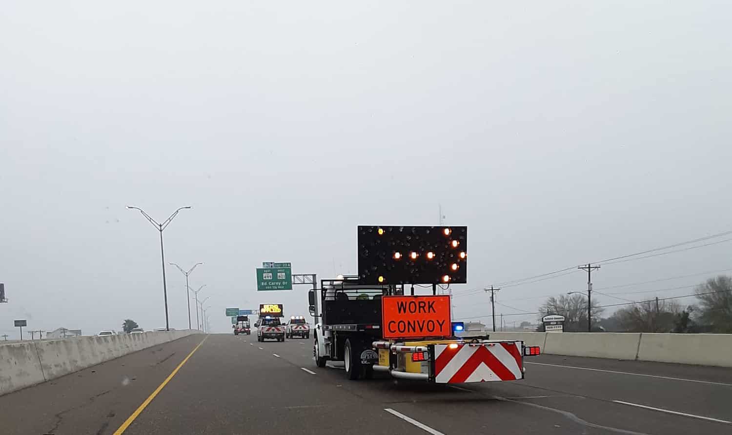
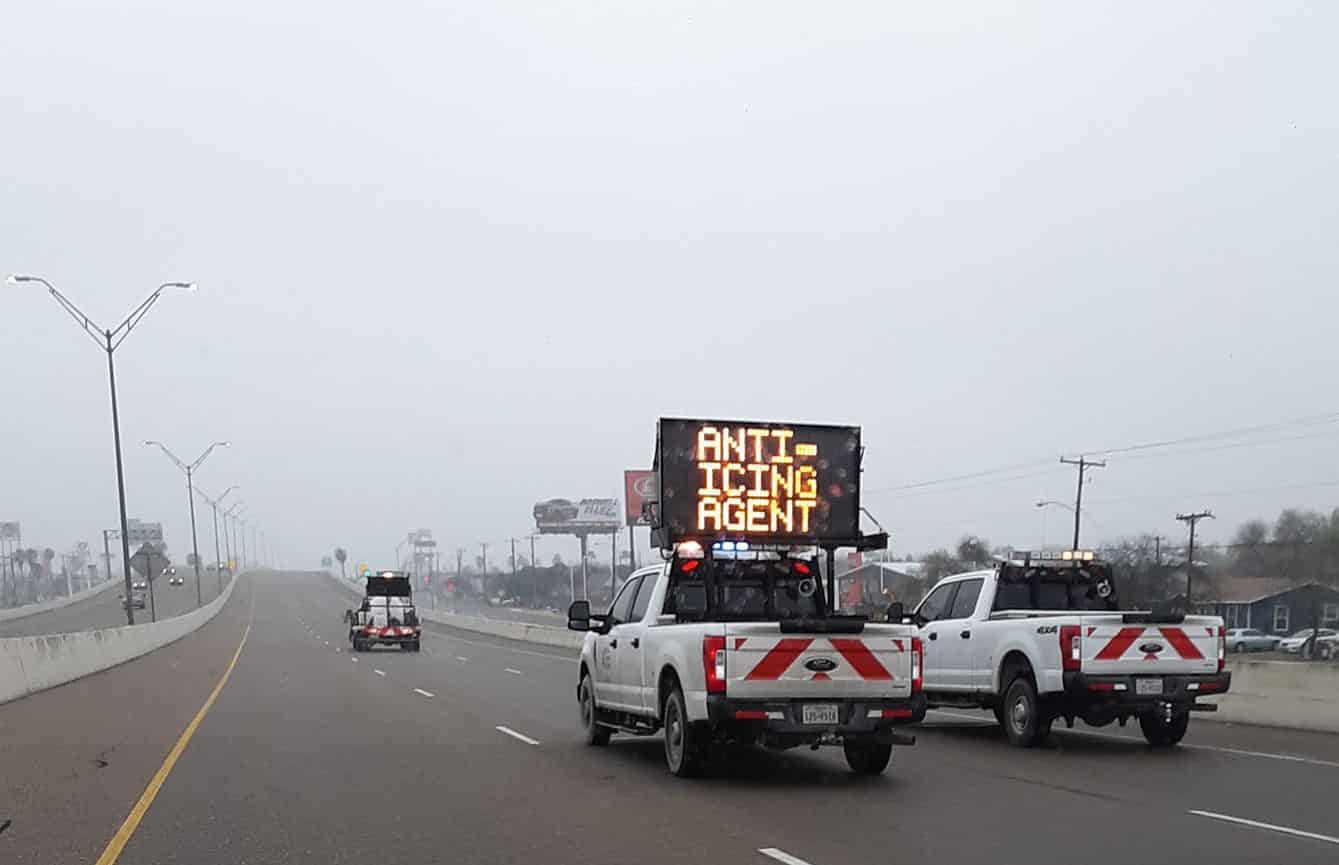
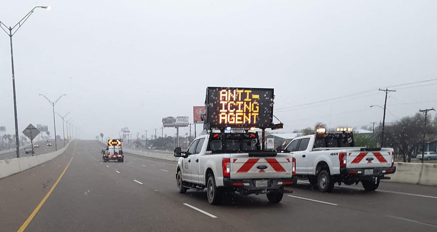
The combination of conditions will make untreated roads dangerous for the Monday commute. On Saturday, crews with the Texas Department of Transportation were laying anti-icing material on overpasses on Expressway 77/83.
Daytime temperatures on Monday will rise above freezing by noon, but will range between 32-36°F by mid afternoon.
Goldsmith says a hard freeze is expected to follow Tuesday morning across South Texas as temperatures linger between 20 to 27°F, if clouds clear up the temperature will drop to 18 to 23°F.
Because the freezing temperatures are impacting the entire state, a high demand on Texas’s power grid is expected starting midnight on Monday through Tuesday at noon. Residents are cautioned the demand to conserve power at home in order to avoid rotating outages.
Forecasters stressed the importance of staying off the roads Monday from midnight to noon. Light freezing precipitation and temperatures in the 20s will make driving conditions highly dangerous.
Those on the water over Laguna Madre and the Gulf of Mexico are warned of a gale event with strong winds over 40 knots and very high and extremely rough seas, a Beaufort Scale 8. The event is expected from 12 a.m. Monday through 12 a.m. Tuesday.
Sea smoke from cold air overrunning the warm sea surface may form Monday at 6 a.m. through Tuesday at 9 a.m. over the Laguna Madre and Gulf of Mexico. The smoke will reduce visibility below 1 nautical mile. Freezing spray is also possible along Laguna Madre.
Pelicans may become stranded along Padre Boulevard and Highway 48 Sunday through Monday evening. Sea turtles may experience stunning, a form of hypothermia.
Residents are urged to protect the elderly and medically vulnerable without heat. People should be in shelters by Sunday evening. Several will be open across the Valley. (CLICK HERE FOR LOCATIONS)
Pets should be brought indoors; plants should be covered to ensure survival; and pipes can be insulated to keep them from bursting. A slow drip overnight through Tuesday noon could also help.
Forecasters warned the greatest danger potential will be from Sunday overnight through Tuesday at noon. Freezing temperatures could last a few hours on Monday or more than a day.
“We haven’t seen the values of what we’re going to show you in a very long time possibly going into the last century,” Goldsmith said.
_____
12:22 p.m.
The Valley will be getting a mix of rain, freezing rain or sleet starting Sunday night and continuing into Monday morning.
The National Weather Service in Brownsville says total ice accumulations should be less than one tenth of an inch.
Forecasters say an upper level trough of low pressure will be approaching South Texas from the west this weekend. As the low pressure moves in another Artic blast will arrive right behind it. This will cause temperatures on Sunday night to fall below freezing for several hours and increase the chance of moisture.
The precipitation will likely start as a cold rain during the day Sunday, and will then turn into sleet or freezing rain from Sunday evening through Monday morning. The precipitation should end by Monday night.
Wind chill values are expected to drop into the 20 to 30 degree range.
The wind chill advisory goes into effect at 6 p.m. Saturday and the winter storm watch goes into effect Sunday evening through Monday morning for Cameron, Hidalgo, Willacy, Starr, Kenedy, Brooks, Jim Hogg and Zapata.
On Saturday morning, Texas Department of Transportation crews applied anti-icing agent to the overpasses of Expressway 77/83 in Harlingen.


