

HARLINGEN — It’s safe to say the drought is over.
A shocking 72-hour rainfall total of 14.65 inches in Harlingen left homes, cars, streets and yards under water as a slow-moving tropical disturbance lurched and danced over the Rio Grande Valley.
The heaviest rain began about 4 p.m. Tuesday, coming and going and then returning with wet vengeance. By 4 a.m. yesterday morning, hurricane-level moisture poured down in what almost could be termed Biblical intensity.
“A foot of rain will catch everybody’s attention,” Jason Straub, a meteorologist with the National Weather Service in Brownsville, said yesterday.
More rain coming?
Straub said there is a good chance of even more heavy rain all day today.
“The area of low pressure is going to stay in the vicinity for the next 24 to 36 hours so the threat of heavy rain is still a possibility” through today, he said. “We still have flash-flood watches up … and (will probably) need to extend them.”
By tomorrow, high pressure should move back into the Rio Grande Valley and some normality will be restored.
“Later in the day Thursday into Friday, high pressure starts to move back,” Straub said. “It brings an area of drier air into the region which will help shut down the rain chances for the Valley for Friday and it looks like most of the weekend.”
The Harlingen record rainfall for June 19 was 2.55 inches set in 1957, and that mark will stand no more.
The 14.65 inches of rain that fell — not including additional precipitation late yesterday and last night — is more than half the year’s average rainfall for the city.
Warnings and more
Two tornado warnings were issued yesterday, one about 4 a.m. for San Benito and another at 6 a.m. for Mercedes. No funnel clouds were sighted. Instead, the warnings were triggered by tornado-like echoes observed in the weather radar.
Valley Metro canceled bus service yesterday due to flooding in low-lying roads, and the Texas State Technical College campus in Harlingen closed for the day due to flooding and continuing heavy rain.
Power outages swirled in and out throughout the Harlingen area, with numerous traffic lights still not operating yesterday afternoon.
In Mercedes and Weslaco, outages apparently were more widespread, and by afternoon National Weather Service personnel in Brownsville said they had still not determined rain totals in those cities due to power and communication problems.
Weslaco finally reported in with 11.04 inches of rain during the three-day period.
Traffic woes
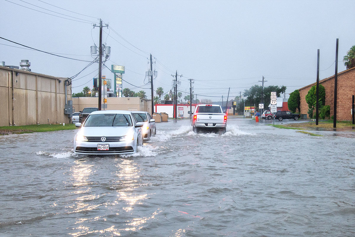
Perhaps mercifully, traffic in Harlingen yesterday morning was light. But across the city, what was moving could best be described as creating “wake zones” without boats.
White plumes of water bubbled and foamed over tires and front bumpers as vehicles moved tentatively through water between one and three feet deep on some city roadways.
At 9 a.m. on West Business 83, traffic was limited to a single lane on the north side of the five-lane highway — and vehicles going both ways were sharing that one lane. Water on the south side of the road appeared to be two to three feet deep, and was a no-go area, even for pickups.
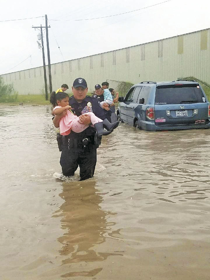
A Harlingen Police Department pickup patrolled the section of highway between Stuart Place Road and Lewis Lane, leading a string of cars and trucks along the single lane drivers were finding manageable. At one point, lights flashing, the police vehicle provided safe cover to a small car with a stalled engine in the middle of the road until a wrecker arrived.
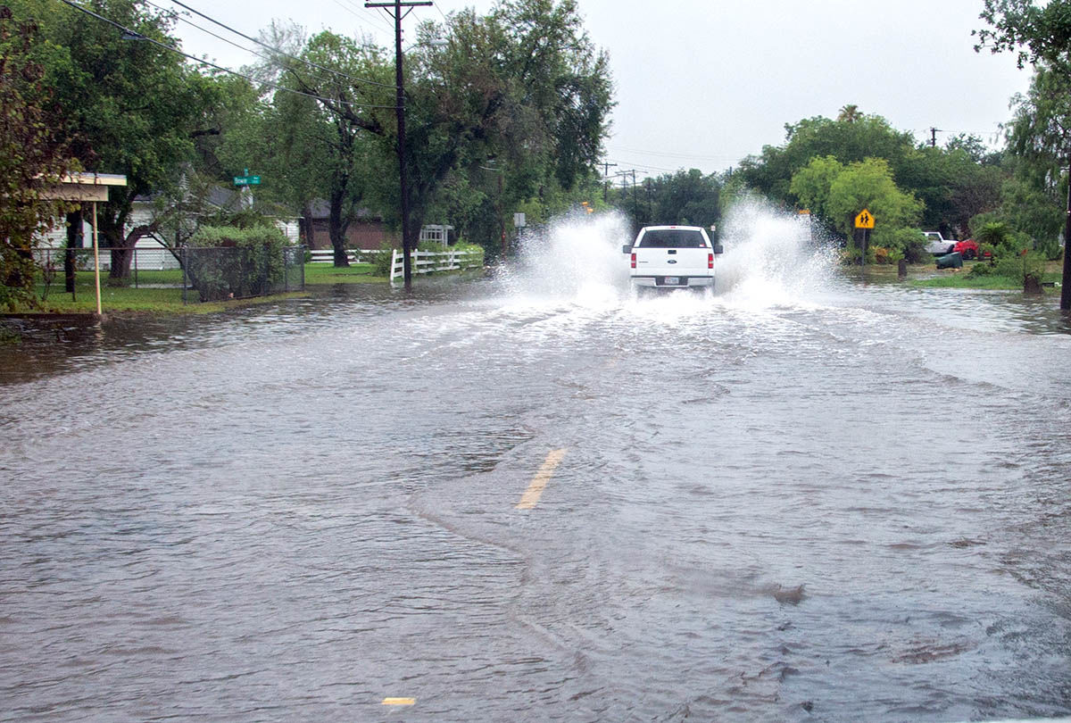
Heading east into the city on West Tyler Avenue, cars continued to push water with their bumpers.
Traffic gingerly moved to the center lane of the street to find the shallowest area atop the road’s crown, with most of the deep water along the curbs on both sides.
Flooding continues
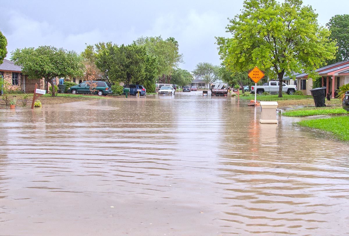
By noon, things had improved but several low-lying areas of the city continued to be beset by drainage problems.
Sam’s Club was a virtual island, with low spots at all entrances still holding one to two feet of water.
Outside the Harlingen Police Department headquarters on Fair Park Boulevard at 3:30 p.m., brave drivers were pushing through water one to two feet deep as they descended from the railroad tracks on the east end traveling west.
Nearby on North J Street, a forlorn car sat abandoned along the curb, water high on its fenders and pushing toward its windows.
Meteorologists reported the Arroyo Colorado near Harlingen reached its highest stage since 2010 without the release of floodway diversion waters.
Blame an odd system
“Pretty much what happened is there was a disturbed area of weather aloft, and it wasn’t a surface feature like we normally see with cold fronts,” the weather service’s Straub said. “It was more elevated.
“It came off the gulf a couple days ago,” he added, “and the Corpus Christi area got the rain for the first couple of days and then the area of low pressure shifted down south toward our area. We had the moisture sitting here for a couple of days so once the lower pressure came back in, everything kind of triggered.”
That disturbed area of low pressure just settled in over the Valley and stayed, Straub said, like an unwanted relative.
“It was a very efficient rain-maker so seeing three to four inches an hour was not out of the question,” he said.
Until the massive rain event, Cameron and Willacy counties had been listed in “severe drought” conditions by the U.S. Drought Monitor, a situation that no doubt will be reversed in the agency’s forthcoming assessments.
“It will probably take two Drought Monitor reports because the rainfall event kind of cut through their cutoff date,” Straub said. “It will definitely pull us back out of that, for sure.”
Harlingen — 14.65 inches
Rio Hondo — 6.64 inches
La Feria — 6.19 inches
Rancho Viejo — 6.80 inches
Los Fresnos — 7.46 inches
Port Mansfield — 8.47 inches
NW Brownsville — 5.03 inches
Weslaco — 11.04 inches
NW McAllen — 6.12 inches
Falfurrias — 12.10 inches
Source: National Weather Service


