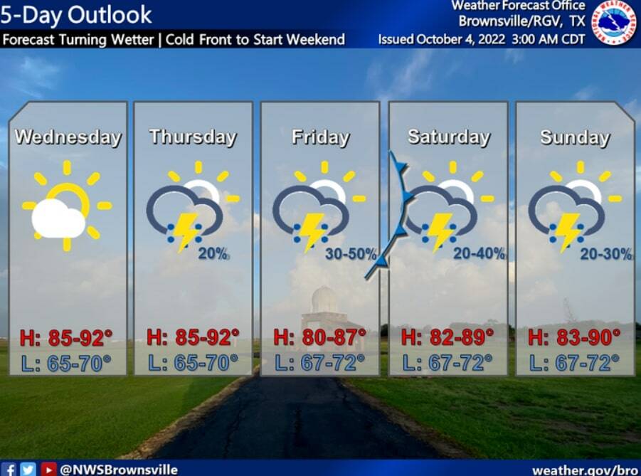
Although another cool front will make its way through the Rio Grande Valley this weekend, it will not bring cooler temperatures.
Instead, it will increase rain chances.
The National Weather Service in Brownsville/Rio Grande Valley reports the passage of a front through the area late Friday into early Saturday morning will bring isolated to scattered thunderstorms.
The passage of the cool front will also lead to generally moderate winds and seas along the Lower Texas Coast, the NWS reports.
There’s a 50% chance of thunderstorms Friday and Friday night, and a 40% chance of thunderstorms Saturday in the Lower Valley.
In the Upper Valley, the rain chances for Friday and Friday night are at 40% and 30%, respectively. On Saturday, there’s a 30% chance of thunderstorms.
The daytime highs across the Valley will be in the low to mid 80s, and the overnight lows will be in the low 70s to upper 60s.
According to the Texas Drought Monitor, none of the Valley counties are experiencing drought conditions, but the levels in the reservoirs that provide water to the area are still low.
As of Tuesday, the Amistad Reservoir was 44.5% full, while Falcon Reservoir was 16% full.