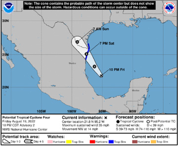
A tropical storm warning was extended Friday night to include Hidalgo County as forecasters predicted tropical storm Danielle would form overnight Friday in the Gulf of Mexico.
The tropical storm warning had been issued for Cameron and Willacy counties earlier in the day.
The disturbance quickly organized Friday afternoon prompting the National Weather Service in Brownsville/Rio Grande Valley to issue the tropical storm warnings.
A tropical storm warning means that tropical storm conditions are expected somewhere within the warning area within 36 hours.
The disturbance was located about 400 miles south-southeast of Brownsville early Friday evening and 440 miles south-southeast of Port Mansfield. It was traveling at 14 mph with winds at 35 mph.
For Hidalgo County, peak winds are forecast to be 15-25 mph with gusts to 30 mph. Rainfall totals of 1-3 inches were projected bythe NWS.
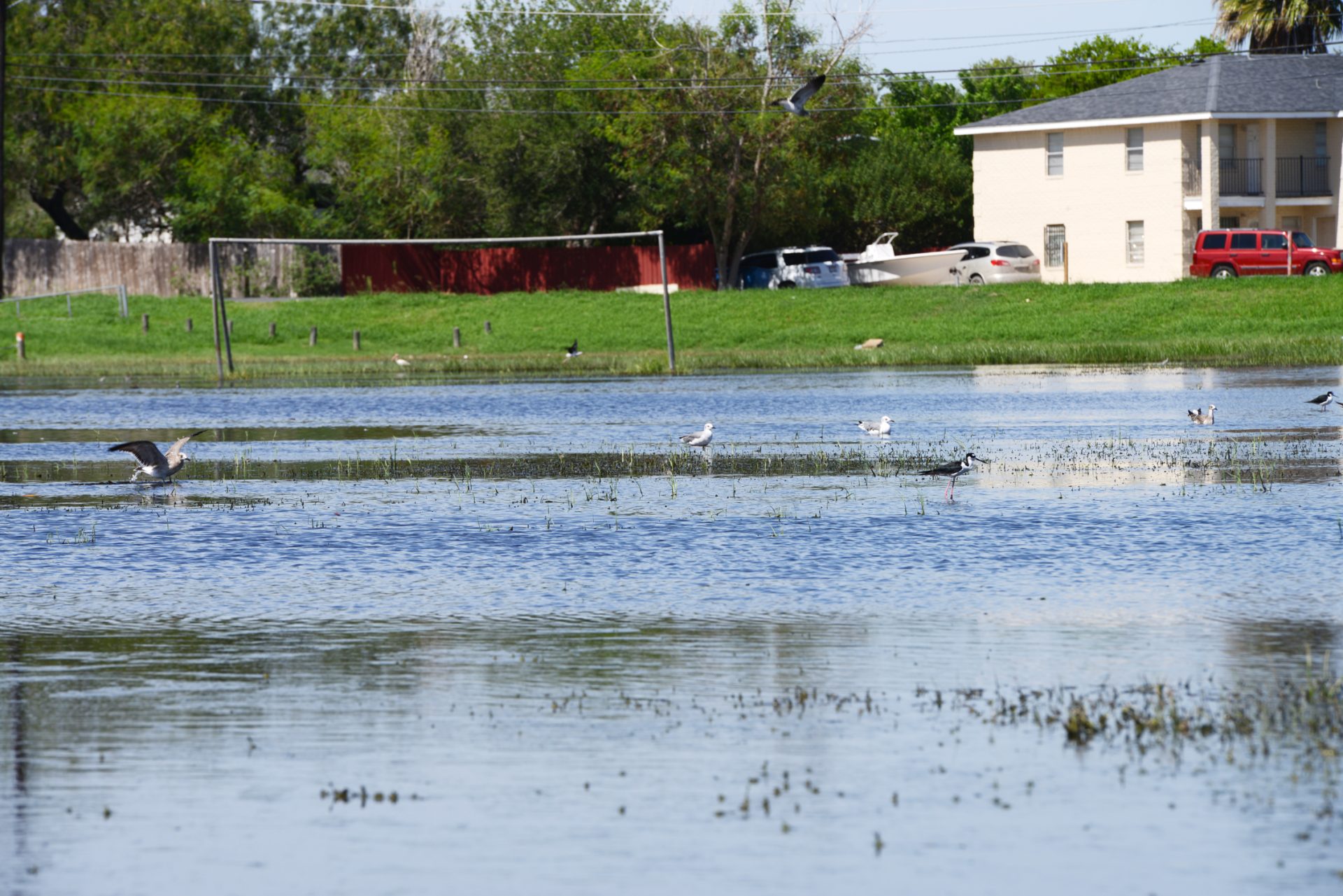
The tropical storm warning prompted some Valley governments to ready sandbags for distribution on Friday, should they be needed.
The primary impact of the storm will be Saturday afternoon through just after midnight Saturday, the NWS reports. The primary impacts will be felt across the lower Texas Gulf waters and Cameron and Willacy counties. There’s a potential for locally heavy rainfall and minor flooding.
Rainfall amounts of 2 to 3 inches are possible with the possibility of 5 inches in Cameron County and 4 inches in Willacy County. These rainfall amounts could cause 1 to 2 feet water depth in poor drainage locations Saturday afternoon and Saturday evening.
Gusty winds 40 mph mainly along/east of IH69C could cause minor damage to unfastened items and cause difficult driving. Tropical storm force winds across the Gulf and Laguna Madre will make boating difficult to impossible Saturday afternoon into the evening.
In addition, surf waves and tidal run up will be dangerous on the beach Saturday. Residual rip currents continuing into Sunday when the sunshine returns could be more impactful to unaware swimmers. Tidal run-up on South Padre Island, nearing the dunes could occur Saturday afternoon/evening.
The winds should begin to affect the impacted areas Saturday evening but could begin as early as Saturday afternoon, the NWS reports. There’s a potential for tropical storm wind gusts in the upper Rio Grande Valley and brush country but this depends on how long the system can remain intact on land.
Weather forecasters have been watching the tropical wave in the Gulf of Mexico and Bay of Campeche for several days and earlier predictions indicated there was about a 20 to 40% chance of development. However, the disturbance continued to develop quickly with those chances up to 80% Friday afternoon.