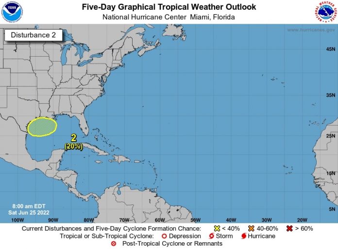
The National Hurricane Center is watching for the potential for an area of low pressure to develop in the northern Gulf of Mexico early next week.
This potential area of low pressure has been given a 20% chance of development into a tropical cyclone within the next five days.
At this time, it is too early to tell what impacts, if any, this system will have on Deep South Texas and the Rio Grande Valley, the National Weather Service in Brownsville/Rio Grande Valley reports.
The NHC is also watching an area of cloudiness and showers that have become a little more concentrated near a tropical wave located over the central tropical Atlantic Ocean.
The NHC states environmental conditions appear conducive for development of this system over the next few days, and a tropical depression could form during the early to middle part of next week.
This system is forecast to move westward at 15 to 20 mph over the tropical Atlantic, approach the Windward Islands on Tuesday, and move into the southeastern Caribbean Sea by Wednesday, the NHC reports.
It has a 30% chance of development over the next two days, and a 60% chance of development over the next five days.


