After days of anticipation, that long awaited cold front will push through the Rio Grande Valley tonight bringing not only cooler temperatures, but storms that can possibly produce damaging winds and hail, forecasters report.
According to the National Weather Service in Brownsville/Rio Grande Valley, the Storm Prediction Center has upgraded portions of Jim Hogg, Brooks, Kenedy and Willacy counties to a “slight risk” for severe weather, while the remainder of Deep South Texas, including Cameron and Hidalgo counties, remain in a “marginal” risk.
“We do have a slight chance or an isolated chance of seeing some strong thunderstorms overnight with the front, that’s a possibility,” said Brian Mejia, a meteorologist with the NWS. “Maybe one or two storms could produce strong wind gusts or large hail. Those are two main concerns within the thunderstorms as it kind of gets organized.”
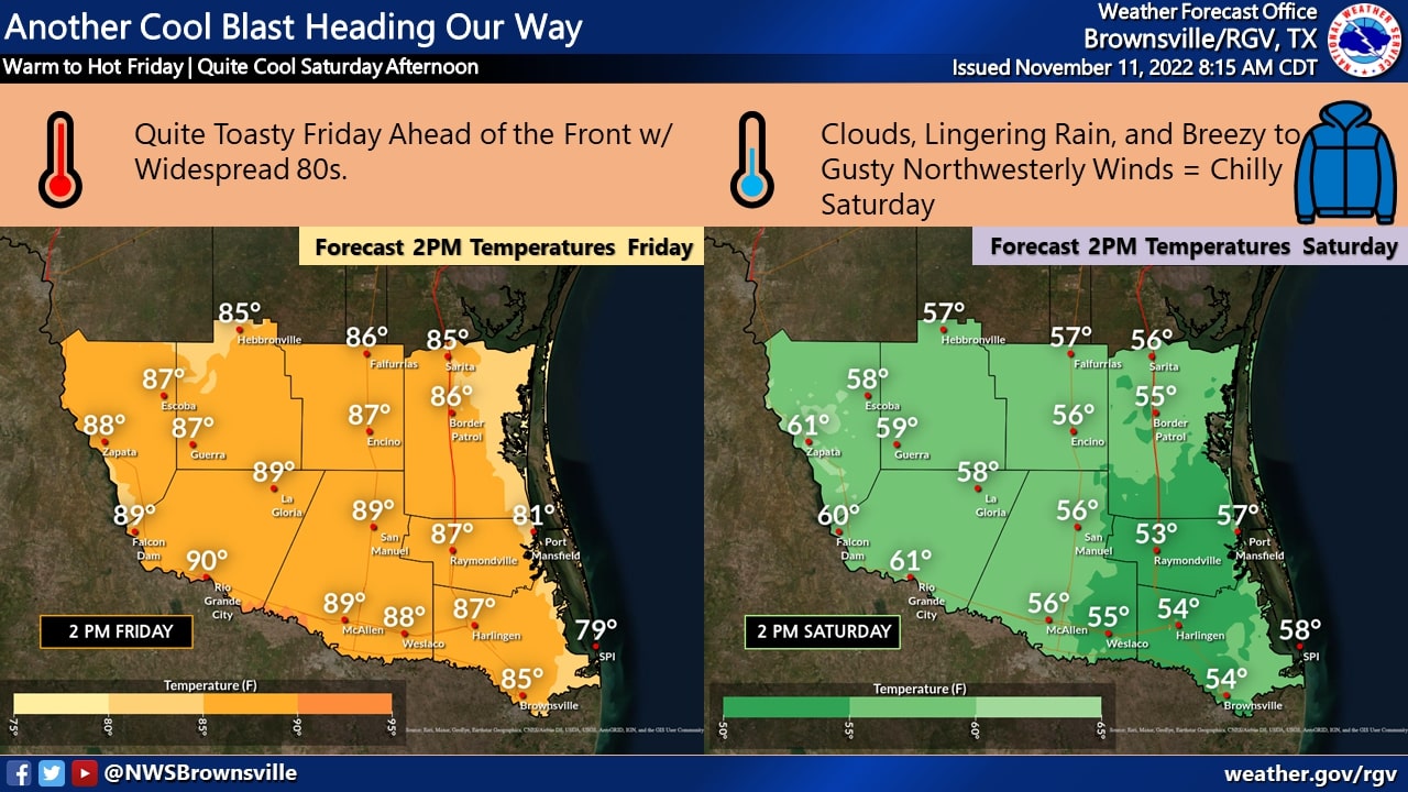
But before those cooler temperatures arrive, we will have to deal with muggy temperatures today with daytime highs in the upper 80s and low 90s.
“You will know when the front comes through because it will be a significant change,” said Mejia. “First you will notice the winds, the winds will increase behind the front.”
Mejia said the cold front is expected to push through the McAllen area sometime between 9 p.m. and 10 p.m. tonight, and the Harlingen area around 11 p.m. It will then make its way through Brownsville sometime around midnight.
There’s a 70% chance of showers tonight across the Valley. “There’s a decent chance that most populated locations will see at least something, at least a shower or something,” Mejia said.
The winds behind the cold front will be gusty at about 30 to 40 mph late tonight into early Saturday morning.
Tonight’s overnight low will be in the upper 40s to near 50s. The highs on Saturday’s will remain in the 50s.
“A significant change is coming for tomorrow,” Mejia said.