

HARLINGEN — A fast-moving storm front powered through the Rio Grande Valley on Wednesday, slashing through the region with lightning, high winds and heavy rain.
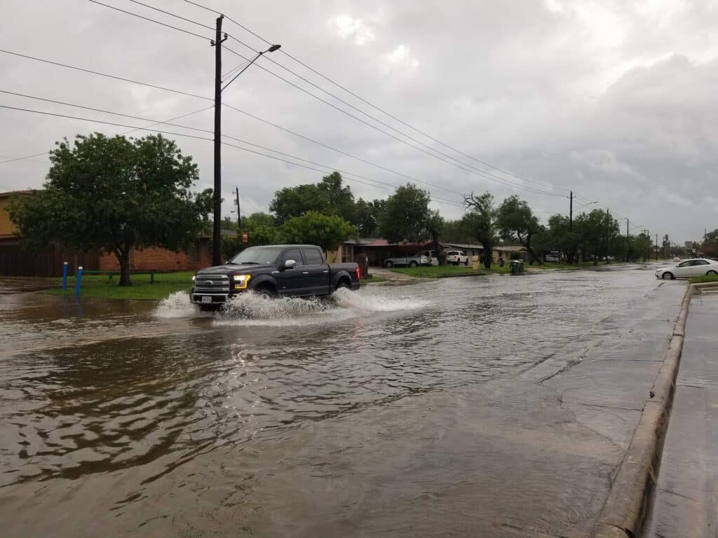
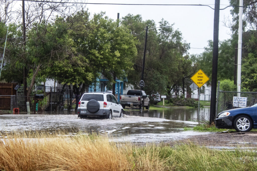
As expected, street flooding was widespread across the entire Valley, with hundreds of reports of low-lying city streets and interstate frontage roads inundated with high water.
A flash-flood warning was in effect until about 4 p.m., but that expired, leaving a flash flood watch which will remain in effect until this afternoon.
But the most severe weather, including forecasts of possible one-inch hail and potential 70-mph winds, failed to make an appearance, and initial reports indicate storm-related damages appear to range from little to non-existent.
Storm tracking
Casual thunderstorms popped up across the Valley beginning around dawn, but the serious storm line hit the McAllen area around 8:30 a.m., before churning its way east through Weslaco, Harlingen, Brownsville and eventually Port Isabel and South Padre Island.
In McAllen, wind gusts of 39 mph were recorded at McAllen-Miller International Airport around 9 a.m., and between 8:30 a.m. and 10 a.m., 1.9 inches of rain had fallen.
In Harlingen, just before 10 a.m., the sky turned practically midnight black, illuminated by spasms of vibrant lightning. Winds were 29 mph, with a top gust of 37 mph recorded at Valley International Airport around 10 a.m.
In Brownsville, the front hit about 11 a.m., with strong lightning, rain, and the highest wind gust of 48 mph recorded at Brownsville-South Padre Island International Airport just after the noon hour.
The storm front continued its jaunt to the east, eventually reaching the SpaceX facility at Boca Chica Beach just after 11 a.m., causing the live cam of the launch site to shake and rattle as black clouds descended to what looked like the tops of the tall industrial cranes.

Lights on for most
Power outages were relatively low in number given the strength of the storm system, certainly nothing remotely comparing to the electricity disaster during the February freeze.
At 11 a.m., AEP Texas reported about 200 Valley residents without power, although system-wide the total was around 12,000. AEP Texas serves just over 1 million customers across the state.
Magic Valley Electric Cooperative reported about 2,000 customers without power around the same time, most of whom were located south of Pharr.
By 1 p.m., AEP Texas still had a couple of hundred customers out in the Valley, while Magic Valley reported 3,800 customers without power, including 1,352 in the dark in Harlingen.
By 3:30 p.m., AEP Texas continued to report around 200 Valley customers without power, while Magic Valley reported about 2,700 customers still without electricity.
Rainfall totals
With rain still coming down in late afternoon, unofficial rainfall totals from the National Weather Service in Brownsville showed McAllen having received 7.68 inches of precipitation as of 3 p.m.
Harlingen had received around four inches of rain, and Brownsville had received more than three inches.
But more is on the way, with rain forecast each day through at least Monday, according to the weather service.
Chances are 20 percent to 40 percent today and Friday, 40-50 percent on Saturday, 50-60 percent Sunday and 30-40 percent on Monday.
The rainfall amounts over these next few days are not expected to match the heavy deluges of Wednesday, however.
Cameron County
Tom Hushen, Cameron County Emergency Management coordinator, said Wednesday afternoon that no major damage has been reported in the county.
“We’ve had some street flooding,” he said. “Our low-lying areas, we’ve had teams out there, and it hasn’t hit the houses and it’s starting to slow down. I think it’s going to be all right.”
Hushen said he and his staff are still monitoring the forecast for even more rain through Monday.
“But as long as it’s moderate it won’t rise any more, but it still won’t go down until it clears,” Hushen said. “But we should have our streets clear within the next couple of hours.
“I can’t rule anything out, but for right now, it’s looking good,” he added.
Hidalgo County
Ricardo Saldana, Hidalgo County Emergency Management coordinator, said no damages were reported from the storm front, but he said he and his staff continue to monitor the prospect of continued rainfall through the weekend
“We have had flooding on our roadways, and checking in with the municipalities, that’s basically what we’ve had throughout this rain event from this morning,” he said Wednesday afternoon. “The water’s starting to recede, and as long as this rain stays the way it is, we’ll be OK.”
Saldana said the rain the county received Wednesday was in addition to heavy rain, some 2 to 3 inches, the county was hit with last Saturday.
“It is concerning because our ground is saturated,” Saldana said. “I’ll give you a good example. Back in 2015, we had a similar situation where we had one day of good rain and then in a couple days we had another round of good rain, and finally we had a good downpour and our ground was so saturated, the water had no place to go but to stay on top and start flowing.”
“We don’t need another flood event,” he added.


