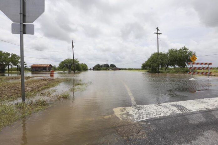
In case you’re wondering why the rain kept coming in the Rio Grande Valley days after Hurricane Hanna blew through, and whether it was in some way related to the storm itself, Barry Goldsmith has an answer for you.
The warning coordination meteorologist with the National Weather Service Brownsville station said the lingering precipitation — which continued to hammer some areas already saturated by Hanna — wasn’t directly related to the Category 1 hurricane, though it was related indirectly. In response to an emailed query from the Herald, Goldsmith said the hurricane was “embedded in a larger areas of atmospheric spin.”
Hanna’s low-level circulation dissipated fast as the storm exited the Gulf, its source of fuel, and ran into the high country of the Sierra Madre late Sunday, though the atmospheric spin remained and “hung out” from the upper Valley to northern Nuevo Leon state in Mexico, he said. A flow of deep tropical moisture on the spin’s east side, combined with daytime heating on July 27 and favorable overnight conditions over the western Gulf from east of Tamaulipas to the lower Valley July 28-29 provided sufficient moisture for more showers and thunderstorms, Goldsmith said.
“Based on the location and shape of the atmospheric disturbance, these (had) been moving from southeast to northwest, often over or near the areas that received Hanna’s heavy rainfall,” he said.
Storms fired up over Jim Hogg County on Tuesday thanks to daytime heating, though the Valley was largely overcast that day, and Wednesday morning’s storms were made possible by favorable conditions in the Gulf overnight, Goldsmith said.
According to an initial NWS report released Thursday, the combined result of Hanna and subsequent rain bands July 24-29 was very heavy rain over several counties in the tip of Texas, with a wide swath of the Valley receiving five to nine inches, significant portions getting nine to 13 inches, and a few small pockets receiving up to 15 inches of rain during the period.
Cameron County experienced flooding but was spared the worst, especially compared to communities in Hidalgo County. Northern Cameron County and much of Willacy County also received significant levels of precipitation, while Brownsville got off relatively easy, with less than 4.6 inches of rain and little in the way of wind.
Look for rain-free conditions for the foreseeable future, Goldsmith said, noting that the overall long-term pattern features general, upper-level high-pressure zones in the Southwest and east of Florida. The Southwest ridge is farther west than the classic La Canicula (dog days) position, which is from southeastern New Mexico with an axis toward the Valley, he said. Between the two ridges will be periodic weaknesses to allow the occasional sea breeze “or other enhanced moisture” beginning next week, Goldsmith said.
“Bottom line? We get back to normal for a while,” he said. “Temperatures by day may need a week to fully recover with all of the water in the ground in the RGV, so it may take some time to see triple digits return to McAllen — if at all.”


